 Background: The Alder Slope Cemetery was founded in 1870 and most of the known gravesites were marked with wooden crosses. When the historic cemetery was ravaged by a wildfire the historical society contacted GPR Data to help preserve the region’s history by mapping the gravesites.
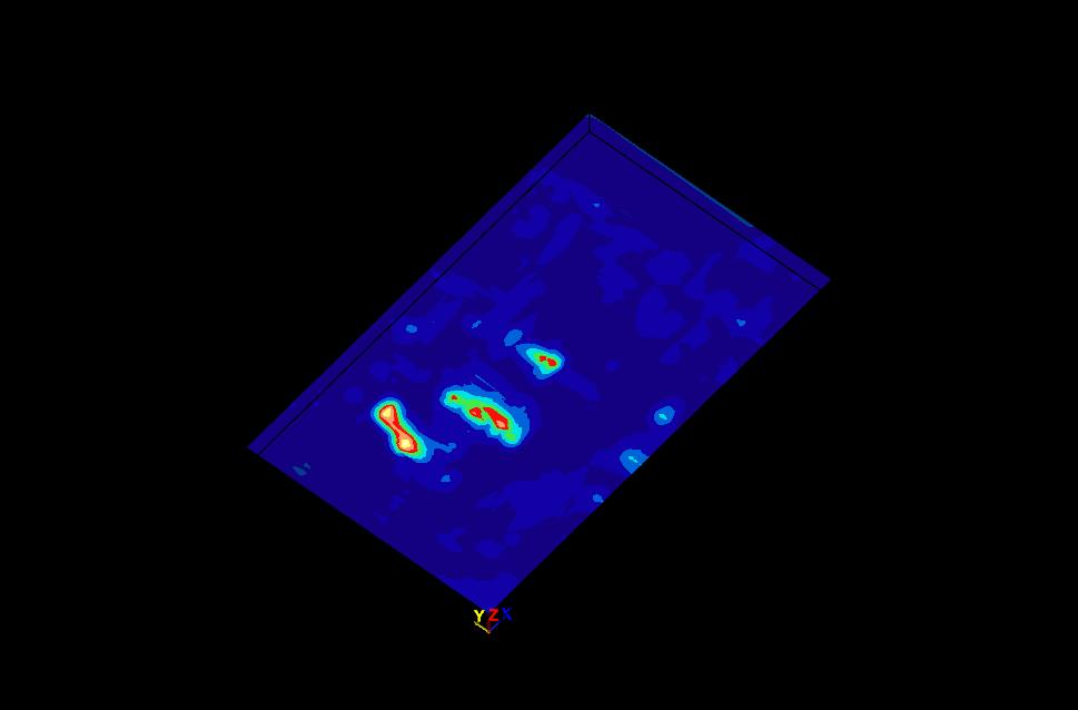
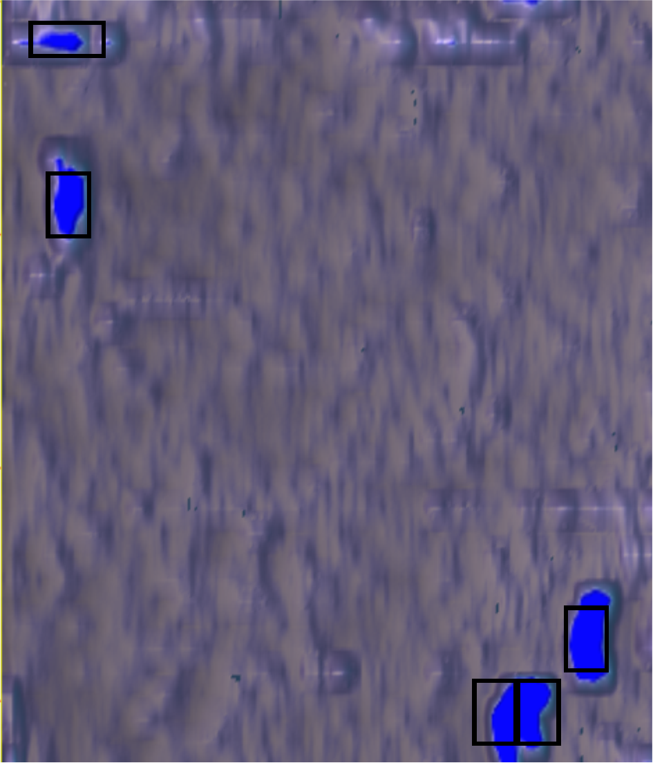
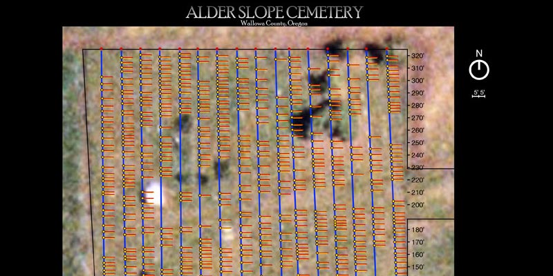
GPR Data’s Solution: GPR Data used multiple GPR antennas to create a 3D map of the cemetery, then identified dominant rows of graves, and finally mark out all the corresponding locations. The located gravesites were temporarily marked in the field so historians could place more permanent markers. Additionally, we provided a reference map based on satellite imagery so that these locations would never be lost to history.
Learn more about Archaeology and Grave Site Mapping