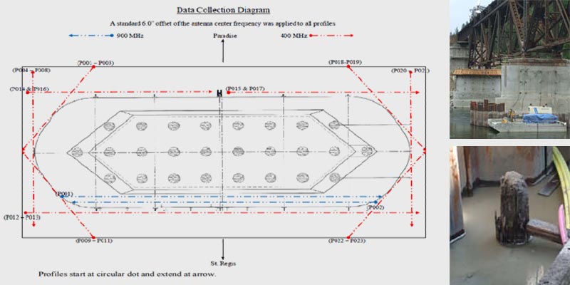
Montana Rail Link Bridge 209 was constructed in 1908 and is situated 12.2 miles north east of St. Regis, MT. on the Clark Fork River. It is a four span railroad bridge resting on concrete piers. Pier 3 is located in the middle of the Clark Fork River and is the center of this GPR evaluation. Over time the upstream face of the pier has experienced the most dramatic weathering and erosion. A large scour was discovered on the southeast portion of the upstream face towards the base of the pier. During a construction phase of stability upgrades to Pier 3, wooden timber fragments were discovered while installing micro pile along the sides of the pier. The wooden fragments were at a depth of 8.0’ to 10.0’ below river bottom and came up in drill tailings on both sides of the pier. Upon discovering this wooden material, drilling was halted in order to complete pier mapping and determine if the wooden material are pieces of the original structural piling installed when the pier was constructed or unrelated construction debris. It was assumed that the original wooden piles around the base of the pier had been eroded away and were no longer there.
Objective:
Use ground penetrating radar to find location and orientation of wooden pilings.
Findings:
GPR Data:
- provided our client with images of the wooden pilings beneath the pier.
- proved that the pilings were at an angle which extended underneath the pier.
- proved that on the upstream side, wooden pilings are still embedded in the pier body.