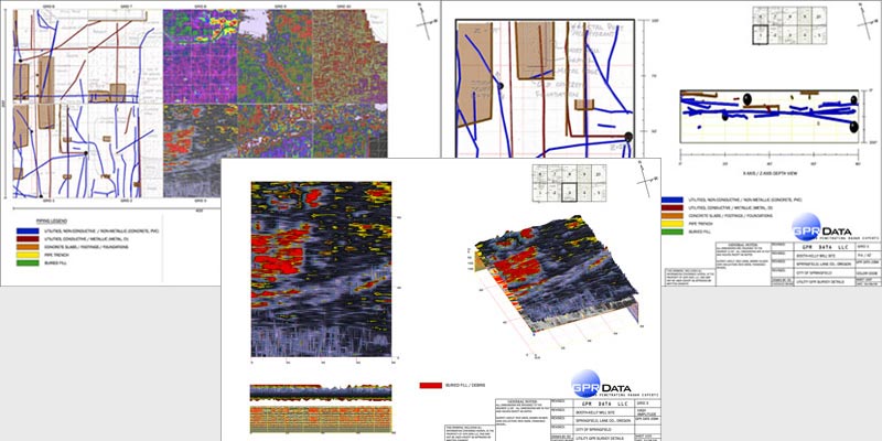
The Booth Kelly Lumber Mill in Springfield is a historical icon, dating back to the late 1800’s. As the years passed, numerous fires engulfed the mill, and each time the remnants were typically plowed under and the structures rebuilt. As utilities were added and replaced, old pipes were sometimes abandoned, sometimes only partially removed. In the end, no cohesive record of utilities was retained, and subsurface relics and debris were anyone’s guess. Therefore, 3d utility mapping was needed.
 Objective:
Promote future development in a historic and underused site:
- Recreate as-built diagrams of underground utilities.
- Map all significant unnatural subsurface features.
- Conduct a complete GPR survey of a 400′ x 200′ area.
Findings:
A series of as-built information was generated from this 3D Ground Penetrating Radar utility mapping survey. Pipe locations are shown in the four subgrids on the left, while amplitude maps describe subsurface features in the six subgrids to the right.