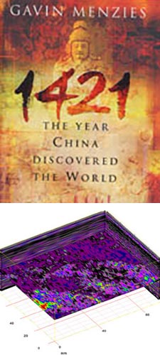
GPR Data LLC was contacted by Dave Cotner Senior from Lakeside, Oregon in April of 2007 with regard to geological investigation of a buried Chinese Junk that was deposited on the Oregon coast in the early 1400’s by a tsunami originating off the coast of New Zealand. Site conditions, terrain, depth of investigation, sub-surface composition, and accessibility were discussed. GPR Data LLC proposed a preliminary site evaluation, as standard practice, to determine the feasibility of GPR, test survey the proposed location, and acquire the exact site and sub-surface conditions to forward model the data acquisition plan for this site. This preliminary evaluation was conducted on May 2, 2007, by GPR Data LLC personnel Mike Edwards, Matthew Edwards, and Thomas Royer. Following the preliminary study, a date was set to procure data acquisition on May 22, 2007. This survey was witnessed and observed by Dave Cotner Jr., Dave Cotner Sen., and Gavin Menzies, author of the book, 1421 The Year The Chinese Discovered America.
 GPR Data LLC extends great thanks to 1421, Gavin Menzies, Dave Cotner Sen., and Dave Cotner Jr. for allowing us to provide geophysical evidence to help aid the forward progress of the project. We are honored to be a part of something with such great magnitude and discovery.
Equipment and Profiles:
A SIR-3000 (Subsurface Interface Radar) system was used with a 200 MHz and 400 MHz antenna. The system, antenna, and survey wheel used were calibrated on site according to local conditions. A 200 MHz and 400 MHz deep penetration profile was used with the target window at 150 nanoseconds; and target depth approximately 40-60 ft. deep were achieved. A relative dielectric was set at 3.09. Using velocity analysis, a standard post-processing procedure, we were able to calculate accurate depths and dimensions for features of interest after the survey was completed.
Each data profile was processed using Radan NT. 6.5007 for Windows software. Each data profile was looped into a 3D model. These models were analyzed using 3D depth slices. The identity of any areas of interest or subsurface features was noted and analyzed further. A terminal depth and slope bottom were set at 60 ft. Markers were placed on any targets above this terminal depth within each 3D data model.
Preliminary GPR Evaluation Methodology:
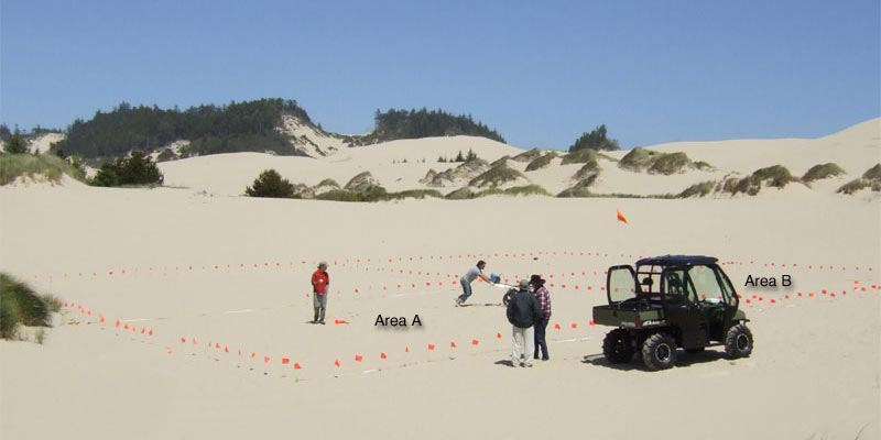
A rectangular grid 60 ft. wide and 160 ft. long was positioned off a GPS coordinate obtained from Dave Cotner Sen. Profiles were positioned to encompass a 30 linear ft. radius around this GPS coordinate. This ensured all potentially useful information in the GPR survey was captured. The subsurface soils were consistent fine grained beach sand. A fresh water interface was noted at 9 ft. deep. The topography was flat, rising in elevation slightly to the north east. The weather was overcast and slightly rainy; the site had been well saturated with rain on the previous night.
GPR Evaluation Methodology:
The survey area for this geological investigation was positioned directly over the wreck site using Dave Cotner Sen., his MAS system, and preliminary GPR survey models provided by GPR Data LLC. The dimensions were divided into two grids, one grid with dimensions 80 ft. by 100 ft., labeled area A, and the other grid with dimensions 80 ft. by 50 ft., labeled area B. Data profiles were collected using a standard Cartesian coordinate system, on two ft. intervals. GPR Data LLC used a 400 MHz antenna on the larger grid, labeled area A, and a 200 MHz antenna on area B. The 400 MHz antenna provides greater resolution in areas where the distance from the surface to the target was not greater than 35 ft.
Findings:
After completing the geological analysis and interpretation of data profiles that were obtained on May 22, 2007, in Winchester Bay, Oregon, we have summarized the following findings; the main portion of the junk is contained in area A, and a broken chunk of the junks bow and masts along with various other items are contained in area B. We base our findings on information provided by Dave Cotner Sen., Gavin Menzies, and the following GPR data.
- Using the drawing of the Junk produced by Dave Cotner Sen. as a known reference for the dimensions, physical characteristics, orientation, and location, of this junk, 3D data models and amplitude maps, obtained from GPR profiles confirm the presence of a large high amplitude zone between 25 ft. and 55 ft. deep.
- A 3D depth slice shows the debris field surrounding the high amplitude zone, as described in area A. An outline of the junk is obtained by point reflection markers.
- A data slice at 19 ft. deep confirms a linear target. The dimensions are consistent with the mast of the junk, and the approximate location provided by Dave Cotner Sen. This feature is positioned in the sand at a slight angle and can be seen in a line scan mode as a linear round target.
- A 2D amplitude map of area A shows amplitude values at 26 ft. deep with 4 ft. target window, it appears that the main body of the junk is contained in area A, and a broken off chunk of the ship’s bow is contained in area B.