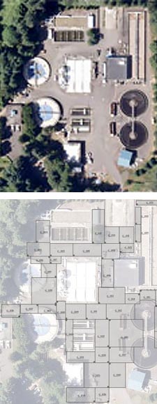
The Wilsonville Waste Water Treatment Plant processes up to 2 million gallons of sewage per day in a major Portland suburban area. This site was originally constructed in 1971, and updated in 1998, but growth and technological advances demand the opportunity to continue improving the facility. The facility needed to locate utilities in order to move forward with improvements.
Previous upgrade cycles and abandonment of various utility and conduit lines have left the site packed with undocumented underground piping. To facilitate future upgrades, GPR Data LLC was called in to provide a complete subsurface map of utilities and piping down to 15′.
 Objective:
- Locate specific known utilities within the site.
- Locate all unknown utilities to 15′ within a 50,000 sq. ft. area.
- Incorporate GPS survey points into resulting data for orientation.
- Deliver data to client in Autocad-ready format.
Challenge:
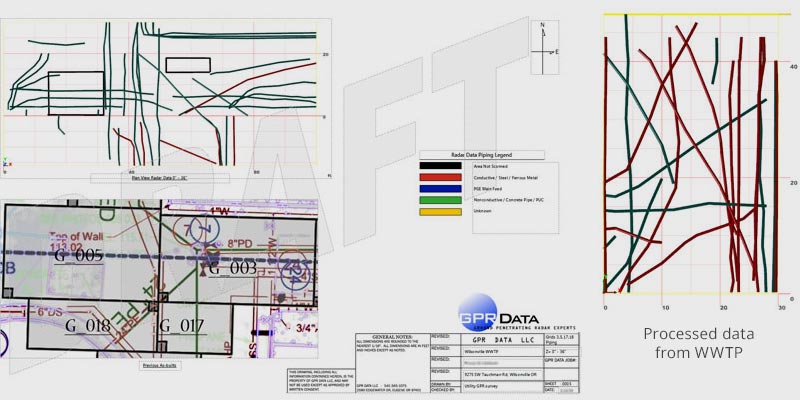
The Wilsonville WWTP job was challenging for several key reasons. Foremost was the simple scope of the project. We created collection grids encompassing 49,632 square feet of surface. Gridding out that much area, around buildings and over a sloping elevation, absolutely was challenging. As you can see in the diagram to the right, our final count was 34 grids of various size, predominantly connected in series.
The second challenge was the variance in target size and depth. Data collection needed to encompass small 1.5″ conduit near surface, large earthen utilities beyond 10′ deep, and everything in the middle. In many areas, large banks of rigid metal conduit travel throughout the site, obscuring visibility of targets beneath.
The final challenge of this site is really a compounding of the first two. Ground penetrating radar provides its clearest signal when the antenna travels perpendicular to the target. Passing a target on angle is not ideal and should be avoided when possible. Unfortunately, the layout of the site features & infrastructure dictated gridlines aligned to N/S, while many of the subsurface utilities travel at angle. Combined with the obfuscation from masses near-surface metal utilities, this presented a challenge which required our full expertise and training.
Results:
Project complete! With innovation at the front end in data collection, and at the back end in processing & integration, GPR Data LLC has continued to advance their role as the leaders in ground penetrating radar service. Much of the deliverable in this project was in the form of 3d model files, so there isn’t a lot to look at, but we’ll include below several images to give you an idea how it looked in there.