Background:
Creating a deterioration map of a bridge deck is a relatively straightforward process for any good GPR company. The technology is extremely well suited to the task. However, all turn-key GPR systems and training are designed for rectangular collections. The reality of roadbeds and bridge decks poses a challenge then, as there is often a varying degree of curvature. In many cases, this bend is shallow enough to be safely ignored, but sometimes it is not…
 Experience:
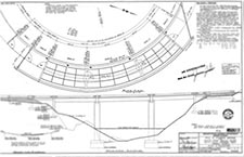
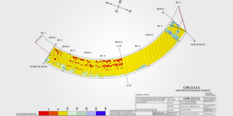
On a recent project in Oregon, GPR Data LLC was tasked with mapping a horseshoe-shaped bridge deck, specifically the area just offset from the apex of the bend. In linear terms, the collection area was roughly 200′ long. A sample of the working plans was provided, as copied to the right with selective blurring.
After collection, processing, and converting back to the original roadbed shape, we were able to provide our customer with a full deterioration report

