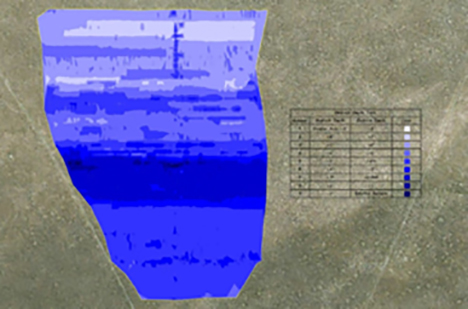
Background: DEPCOM was installing a solar field in an area with highly variable bedrock depth. They knew some array post would need to be drilled and some could be driven. However, they had no way of knowing which specific locations would require drilling.
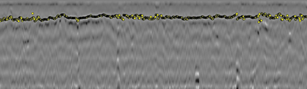
GPR Data’s Solution: GPR Data was able to quickly mobilize to Fort Rock, OR to scan the area focusing on the specific array post locations. After scanning, we were able to provide a detailed map showing which array post had shallow bedrock or large boulders and would require drilling. This information allowed DRPCOM to appropriately plan construction and only drill those locations that could not be driven.