by administrator | Jul 25, 2017
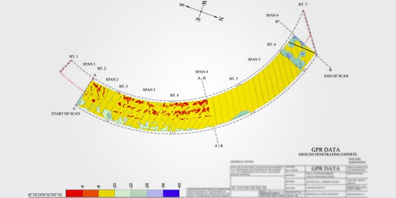
Background: Creating a deterioration map of a bridge deck is a relatively straightforward process for any good GPR company. The technology is extremely well suited to the task. However, all turn-key GPR systems and training are designed for rectangular collections....
by administrator | Jul 25, 2017
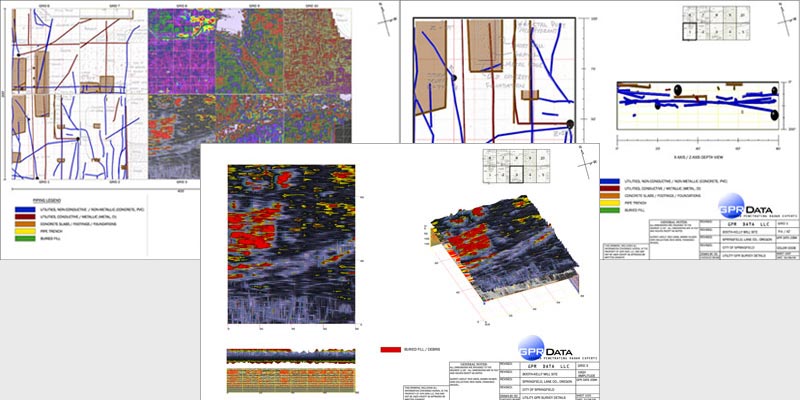
The Booth Kelly Lumber Mill in Springfield is a historical icon, dating back to the late 1800’s. As the years passed, numerous fires engulfed the mill, and each time the remnants were typically plowed under and the structures rebuilt. As utilities were added and...
by administrator | Jul 25, 2017
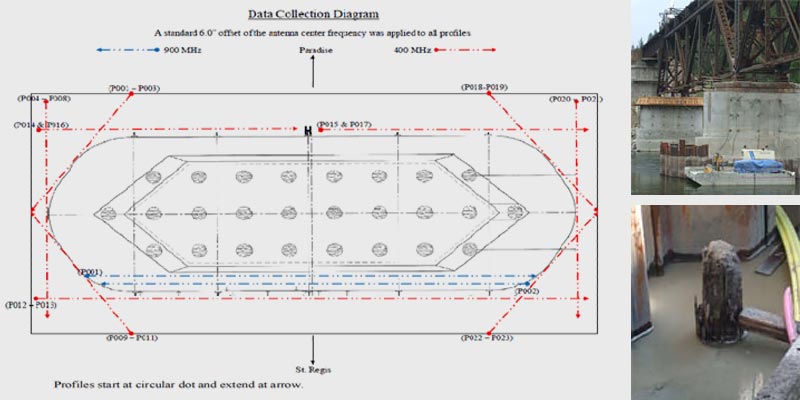
Montana Rail Link Bridge 209 was constructed in 1908 and is situated 12.2 miles north east of St. Regis, MT. on the Clark Fork River. It is a four span railroad bridge resting on concrete piers. Pier 3 is located in the middle of the Clark Fork River and is the center...
by administrator | Jul 25, 2017
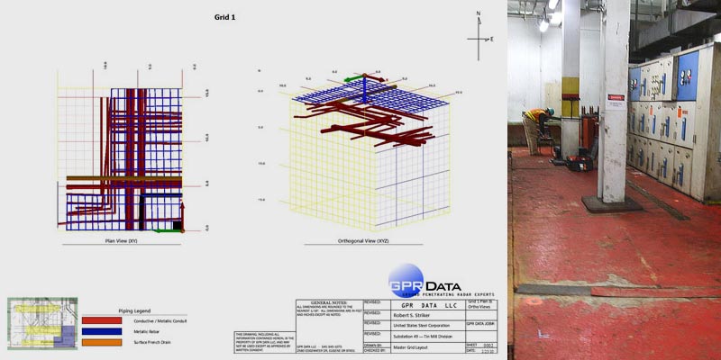
After other ground penetrating radar providers failed, US Steel called in the experts. GPR Data LLC responded immediately to Indiana, to resolve a series of concerns in the concrete slab floor of the electrical room in a factory building, and perform deep concrete...
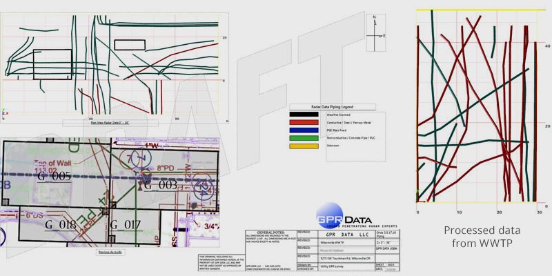
by administrator | Jul 25, 2017
The Wilsonville Waste Water Treatment Plant processes up to 2 million gallons of sewage per day in a major Portland suburban area. This site was originally constructed in 1971, and updated in 1998, but growth and technological advances demand the opportunity to...