Ground penetrating radar (GPR) makes it possible to see what lies beneath the surfaces of buildings, roadways, and bridges. Drilling and X-ray scanning can do this too. What makes GPR so unique and valuable is that it offers non-destructive inspections. GPR inspections can be administered on-site without causing any harm to the environment, structures, or workers.
Using GPR Across Industries
GPR is a geophysical scanning and inspection technology that uses pulsing radar signals to create subsurface images. It was first used to map glaciers. Today, it is used for countless applications, from deck bridge inspections to historical gravesite mapping. What makes it applicable across industries is that it keeps subsurface utilities and sediment intact. It can provide non-destructive evaluations for a host of applications, including the following:
Archaeology
GPR can identify historical foundations, buried relics, and historic roads without disrupting the surface.
Grave Digging & Cemetery Mapping
Ground penetrating radar (GPR) provides a complete map of cemeteries. This includes identifying unmarked graves.
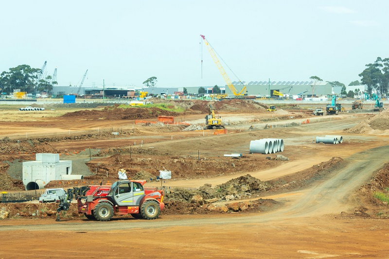
Identifying Tree Root Systems
Many construction and development sites have complex root structures lying beneath the surface. GPR offers a non-invasive method of finding out where roots are without digging.
Bedrock and Boulder Mapping
Ground penetrating radar can map dense and heavily varied sub surfaces without causing any damage. By using 100 to 1000 MHz antennae, GPR technologies can accurately locate and map objects up to thirty meters. GPR works exceptionally well for mapping bedrock and boulders, as it helps unveil any fractures beneath the surface.
Bridge Decks and Rebar Inspection
Ground penetrating radar (GPR) can also be used to inspect bridge decks and rebar. GPR inspections can provide high-definition imaging to reveal deterioration, cracks, and fractures in bridge decks.
Concrete Inspections
GPR inspections can reveal cracks and deteriorations in concrete structures. Additionally, GPR concrete and earth images offer higher resolution and more accurate depth reporting than X-rays.
Environmental Exploration and Mapping
GPR provides a host of valuable data for environmental exploration and mapping. This data can include geologic conditions, depth of water table, and thickness and depth of soil and strata. Aside from offering high-precision data, GPR keeps the soil and strata intact.
Mapping Abandoned Mine Shafts
Ground penetrating technology can also be used to map abandoned mine shafts. Having this technology enables companies to get a clear view of the mine shaft without sending any workers beneath the surface. Since mine shafts are known to collapse and can also contain poisonous or explosive gases, this is a significant step towards keeping workers and entire construction sites safer.
Landfill & Trench Boundaries
GPR eliminates the need to drill or dig to find landfill and trench boundaries. Instead, organizations can use GPR to find boundaries quickly and accurately while leaving work sites intact. Having a clear image of what lies beneath the surface before beginning work can speed up the entire construction process.
Pipeline Leak Location and Inspections
Finding a leak in a pipeline can pose a considerable challenge. Rather than manually looking for the leak, GPR can provide high-resolution data to pinpoint the leak’s origin. With this information, workers can save time and reduce time spent near hazardous liquids or gases.
Buried Utility Location
GPR provides a cost-effective and non-destructive way to locate all utilities beneath a worksite. GPR can be used to locate gas, water, electric utilities, fiber optic cable, metal, and PVC.
Non-Destructive Void Detection
Ground penetrating radar (GPR) offers a non-destructive means for void detection. GPR can detect washouts, basins, utility tunnels, roadways, runways, and buildings. Being able to find voids early in the construction process means fewer potential shutdowns later on.
GPR Is the Environmentally Friendly Choice for Subsurface Imaging
One of GPR’s most compelling features is that it is safe for the environment. Compared to X-ray technologies, ground penetrating radar emits little radiation. Still, GPR can penetrate ice, concrete, rock, soil, and asphalt and produce high-precision data. GPR’s high-quality imaging capabilities and its non-invasive nature make it an ideal tool for archaeologists and environmentalists.
GPR Keeps Worksites Safe and Open
Since GPR doesn’t require drilling or emit significant radiation, it can help keep workers safe and worksites open. Ground penetrating radar (GPR) can reveal all buried utilities, changes in ground strata, voids or air pockets, groundwater tables, rock obstructions, and backfilled or excavated areas before beginning a project.
While GPR is especially helpful at the outset of a project, it is useful at any stage of construction. It can also be used to inspect finished structures for potential cracks, fractures, or fissures.
Other Types of Non-Destructive Technologies
GPR Data Inc. provides a host of non-destructive technologies for innovative 3-D imaging and data documentation.
Drone Aerial Mapping
Drone aerial mapping is a powerful addition to support project planning, risk mitigation, and record keeping. We can perform aerial 4k photography, aerial mapping, and CAD overlays. These maps can capture the data of changing construction sites and be used to generate current “as is” maps of a site.
Full Resolution Ground Penetrating Microwave Radar (GPMR)
GPMR is a technique developed by GPR Data Inc. to prevent aliasing during post-processing and provide contiguous subsurface information in all directions. Our in-house data collection method and 3D processing technique yield crisp, high-definition 3D data.
Impact Echo (IE)
IE propagates impact-generated stress (sound) waves through a structure, which are reflected back by internal flaws and external surfaces. Impact Echo is useful for locating and analyzing flaws in reinforced concrete and masonry structures.
Infrared Thermography (IR)
IR is a thermal imaging technique used to map out infrared radiation levels in an environment. As an object’s temperature changes, so does its infrared radiation signature. Thermography can be used to see into an environment with or without visual illumination.
Ground Penetrating Radar (GPR) Services from GPR Data Inc.
GPR Data, Inc., is a leading provider of non-destructive 2-D and 3-D scanning and imaging. Founded in 1998, GPR Data, Inc.’s team includes experienced geophysicists, licensed CAD and GIS specialists, field engineers, and computer programmers. To learn more about the services we offer, or to request GPR imaging, contact us online or call 541-345-1075.