3D GPR grid scanning is an excellent way to gather information about large and complex subsurface regions. This form of grid scanning consists of two main parts: data collection and data processing. By dividing these tasks between the field and office, the entire process becomes more efficient, accurate, and ultimately more helpful for the client. Still, 3-dimensional scanning is skill-intensive and requires technical expertise from both field and office personnel.
What Is 3D GPR Grid Scanning?
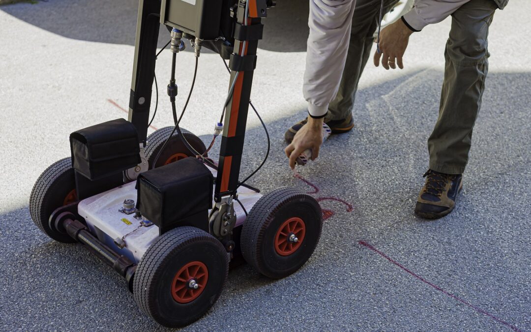
Essentially, a 3-dimensional GPR grid scan will yield a comprehensive 3D model of an area. To create this model, field technicians gather a series of data files for a specific region. The files are then combined to create a complete model of that area. Once the model is manufactured, it can be analyzed to yield valuable findings.
The model can be sliced to examine different depths or elevations at any position. This opens the door to study complex interactions of objects beneath the surface. Additionally, a vector-based model can track the depth and position of nonlinear targets with very high precision.
Strengths of Three-Dimensional GPR Grid Scanning
While three-dimensional GPR grid scanning does not yield immediate findings from the field, it has many unique strengths. Among these are a highly accurate written report of findings, more predictable time estimates, and the ability to efficiently process complex data.
Permanent Written Records
A three-dimensional grid scan yields deliverables that can assist project managers for years to come. The results of the scan and all findings will be documented in a report for the client, which can be filed as a permanent record. The client will be able to take immediate action using these results and also be able to refer to it if questions arise in the future.
Another benefit of having a 3D GPR grid scan completed is the option to plug the model into future projects. We can export the information into AutoCAD files that can then be used for BIM modeling.
More Predictable Time Requirements
A defining feature for 3D GPR grid scans is the division between data collection and data processing. When out in the field, technicians only need to focus on collecting high-quality data. Once collected, they pass the data to the office for analysis. By dividing these tasks, we can better standardize and predict the amount of field time our techs need, which makes it easier to provide a more accurate time estimate for the project.
Ability to Analyze Complex Data Sets
Since grid data is processed later in the office, we are able to assemble and analyze more complex models. In the office, we have access to state-of-the-art software that allows us to assign names and color codes to items. This helps streamline analysis in ways we couldn’t in the field.
Complete Large Projects Faster
Data grids don’t just allow us to work more effectively on complex data, but also to process larger amounts of data more quickly. For large and remote projects, our field crew will collect a group of data grids and then send them to the office. Then, the office will begin processing the data while the field crew continues to collect and send more data. This workflow allows for collection and analysis to happen simultaneously.
When the crew is finished with the collection scope, the office starts delivering reports to the client. Then, the field crew can assist in clarifying any ambiguity with the data and correct any misunderstandings. By working in tandem, the field and office technicians can efficiently churn out very precise and well-documented reports for large areas.
Peer Review Findings
A final benefit of these grid scans is being able to peer review findings before they are implemented. It goes unsaid that the accuracy of GPR is critical and any mistakes can be costly. Before the client receives 3D grids, the reports can be peer reviewed by other technicians to ensure nothing was missed or recorded incorrectly. In addition, the client can always have the reports evaluated again if they need to find something different later on.
Weaknesses of Grid Scanning
As with all subsurface scanning methods, there are several constraints concerning three-dimensional GPR grids. These include fixed costs for each 3D grid, highly-detailed field documentation, and expert field and office technicians.
Fixed Costs for Each 3D Grid
While splitting the collection and processing of data between field and office helps save time, it’s still not possible to know for certain how complex or simple data will be. Still, there is a fixed cost of time required to setup, collect, construct, and analyze each grid. These fixed costs are generally offset by time savings during the process and interpretation phases. However, if the data set turns out to be simpler than expected, there can be less of a price offset from the analysis phase.
Abstractions Can Pose Challenges
Another constraint of 3D grids is the difference in how data is labeled in the field and the office. A 30′ slab may be between columns F and H on line 5 in the field, but when it is processed in the office, it is converted to Grid 23B. This abstraction away from the actual site can make communication difficult between field and tech workers. To mitigate any miscommunication, detailed field documentation is critical.
Detailed Field Documentation Is a Priority
To make sure field and office techs are able to collect and analyze data seamlessly, there needs to be coordinated and detailed documentation, especially in the field. By using consistent labeling and ensuring that all data is recorded accurately, the analysis process is much smoother. The more complex the project, the more important it is to have detailed documentation. For a complex project, field documentation can consume up to 30% of the whole time.
Range of Technical Skills Is Necessary
Creating a three-dimensional data grid calls for a wide range of technical skills in the field and in the office. For multi-grid projects, it’s vital to have expert technicians lead the design and implementation. Additionally, it’s important to have field techs who are familiar with office processing so they can adjust the design of the project for successful analysis. In a similar vein, it’s important to have office techs who understand field work. This will help keep communication clear and efficient.
3D GPR Grids for Complex Projects
When it comes to creating a model for complex subsurface areas, 3D models are invaluable. By using 3D GPR grids, your team can utilize important findings almost immediately and have a permanent record of the area. By coordinating between our field and office techs, we create rich reports quickly and efficiently, regardless of the complexity or size of the project. For an estimate about GPR grid scanning, request a quote through our website today.